
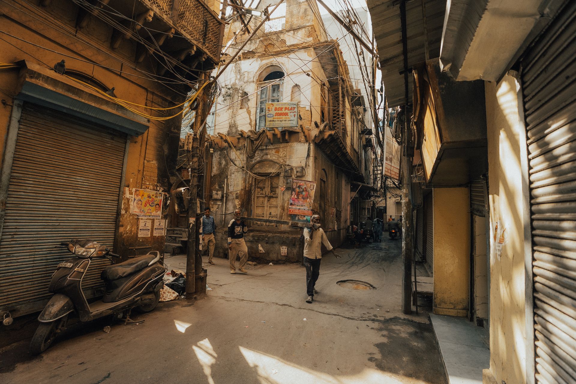
Photo: A narrow old-city street in deep shade, with a strip of sunlight. Credit: Samar Mourya via Pexels.
Guest expert opinion by Dr Naveen Kishore Khambadkone, Associate Professor, BMS College of Architecture, Design and Planning, Bengaluru
Walk from a crowded old market lane into a wide, tree-lined residential street and the change is immediate. It is not only quieter. It feels cooler, brighter and easier to breathe. That difference comes largely from urban morphology, the study of the physical form of cities and the processes that shape it.
What urban morphology studies
Urban morphology treats the city as something that can be read, much as a geologist reads a rock face. Its starting idea is that urban form is not random. It is the accumulated result of land ownership, regulation, economics, culture and climate, layered over decades or centuries. The field has several traditions. The Italian school, associated with Muratori and Caniggia, studied building types and how they form urban tissue. The British school, founded on M.R.G. Conzen’s work on English market towns, focused on plots, street patterns and how towns change over time. The French school connected form to social life and planning. Today the approaches are increasingly combined, and Karl Kropf’s Handbook of Urban Morphology is a good entry point.
The four elements
Most morphological analysis rests on four physical elements, which Vítor Oliveira’s introduction to the field sets out clearly:
- Streets form the skeleton. Their width, orientation and connectivity decide how people, air and sunlight move through a place.
- Urban blocks are the areas the streets enclose. Their size shapes walkability and how much open space a neighbourhood can hold.
- Plots are the parcels of land within blocks. Plot size and shape govern who builds what, and how densely.
- Buildings are the final layer, covering height, footprint, spacing and materials.
Morphologists also stress that these elements change at different speeds. Buildings are replaced fairly quickly. Plot boundaries last much longer, and street patterns can persist for centuries. This is why a historic street grid can hold radically new buildings and still behave much like the old city.
Why form matters for climate
A city’s form is also its climate machine. The ratio of building height to street width controls how much sky is visible from street level, a quantity called the sky view factor. Deep, narrow streets block direct sun and can give welcome daytime shade. The same geometry traps heat radiated back from walls and pavement, slowing cooling at night. Street orientation affects both sun exposure and ventilation, and dense, continuous building can block the breezes that carry heat away. Surface materials, tree cover and water add further layers. T.R. Oke’s pioneering work on canyon geometry and the urban heat island established these links, and the Local Climate Zone system now gives researchers a common vocabulary for classifying built form by its thermal behaviour.
From temperature to human experience
Air temperature alone does not describe what a person on the street feels. Outdoor thermal comfort depends on air temperature, humidity, wind, and above all radiation from the sun and from hot surfaces, combined with a person’s activity and clothing. Indices such as PET and UTCI, and the WBGT used for heat-stress work, try to capture this combined load. Morphology matters here because it shapes every one of these inputs at the scale where people actually walk, wait, work and play.
Why this matters in Indian cities
Indian cities offer an unusually rich set of forms in close proximity: dense historic cores, planned layouts from the twentieth century, industrial areas, informal settlements and rapidly growing peripheries. These sit within hot climates where heat is already a serious public health concern. Prolonged exposure can bring fatigue, dehydration and heat illness, and it falls hardest on people who work or wait outdoors, such as street vendors, construction workers, delivery riders and commuters. Older adults, children and people in poorly ventilated housing face particular risk. Heat also affects sleep, mood and daily routines, so its effects reach well beyond emergencies. Because form is slow to change, design choices made today lock in thermal conditions for generations.
A city like Bengaluru shows this well. Older, compact neighbourhoods, planned residential layouts and industrial districts differ in street width, building spacing, tree cover and surface materials, and these differences plausibly translate into different outdoor thermal conditions and health experiences for residents. Careful field measurement is still needed to say how much. Much of the existing evidence comes from temperate or East Asian cities, and we know far less about how Indian urban forms perform.
Reading the city before reshaping it
Urban morphology gives planners and designers a disciplined way to understand a place before intervening. For heat, this points to practical questions. How wide and how oriented are the streets? Where is shade provided, by buildings or by trees? Can breezes move through the block pattern? What are the ground and roof surfaces made of? Answering these questions neighbourhood by neighbourhood is a sounder basis for heat-resilient planning than applying generic prescriptions from elsewhere.
The city’s shape is not just a backdrop to urban life. It decides who is comfortable, who is at risk, and how well a place copes as temperatures rise.
Sources
- Conzen, M.R.G. (1960). Alnwick, Northumberland: A Study in Town-Plan Analysis. Institute of British Geographers.
- Kropf, K. (2018). The Handbook of Urban Morphology. Wiley.
- Oke, T.R. (1981). Canyon geometry and the nocturnal urban heat island. Journal of Climatology, 1(3), 237–254.
- Oke, T.R., Mills, G., Christen, A. & Voogt, J.A. (2017). Urban Climates. Cambridge University Press.
- Oliveira, V. (2016). Urban Morphology: An Introduction to the Study of the Physical Form of Cities. Springer.
- Stewart, I.D. & Oke, T.R. (2012). Local Climate Zones for urban temperature studies. Bulletin of the American Meteorological Society, 93(12), 1879–1900.
About the author: Dr Naveen Kishore Khambadkone is a faculty member at BMS College of Architecture, Design and Planning, Bengaluru, where he teaches architecture and works on research linking urban morphology, outdoor thermal comfort and human health in Indian cities.
Write for UFI
Have a story about cities? We publish articles and photo essays from researchers, practitioners and photographers.
Pitch us at contact@urbanfrontierinsights.com